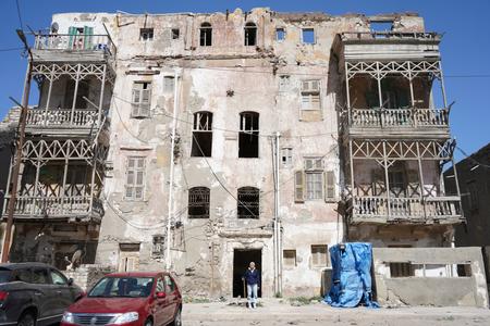
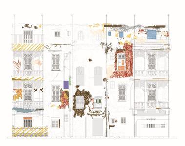
This workshop targets employees at archaeological and heritage sites, as well as students of architecture, archaeology, and restoration. Participants will gain essential knowledge and skills in documenting damage in historical buildings, mapping damage information onto architectural drawings, and creating risk assessment maps using Geographic Information Systems (GIS). The workshop includes both theoretical sessions and practical fieldwork at historical sites, with all necessary tools and materials provided. Don’t miss this unique opportunity to enhance your skills and contribute to the preservation of Egyptian heritage.
Target Audience
Employees at archaeological and heritage sites, students of architecture, archaeology, and restoration.
Workshop Schedule
Day 1: Documenting Damage
- Registration and Welcome.
- Introduction to Risk Assessment in Historical Buildings.
- Methods for Documenting Damage in Historical Buildings.
- Practical Session: Documenting Damage (Fieldwork).
Day 2: Mapping Damage Information
- Mapping Damage Information onto Architectural Drawings.
- Hands-on Session: Using Software for Architectural Mapping.
- Introduction to GIS for Heritage Sites.
Day 3: Creating GIS Maps for Risk Assessment
- Creating Risk Assessment Maps Using GIS.
- Practical Session: GIS Mapping (Fieldwork).
- Final Project: Developing a Risk Assessment Map.
- Closing Remarks and Certificate Distribution.
Notes
- Laptop is Required.
- Certificated Course by The Egypt Exploration Society (EES).
- The training will be for 3 days.
Booking and information
Register for your place in advance using the link below. After registering, you will receive a confirmation email containing information about your booking. If you do not receive your email, then please check your junk folders before contacting the Egypt Exploration Society.
Attendees will receive certificates of attendance from the EES. For questions regarding this event in Egypt, please contact EES Fieldwork and Engagement Manager Dr Essam Nagy.


